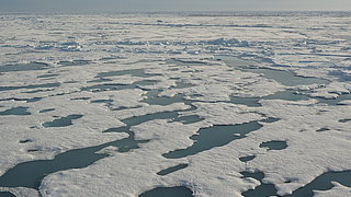
Relevance of melt ponds
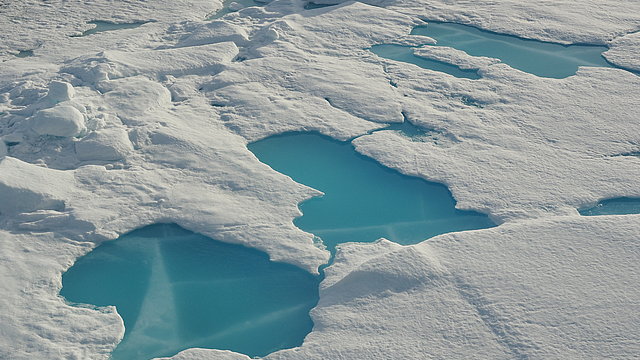
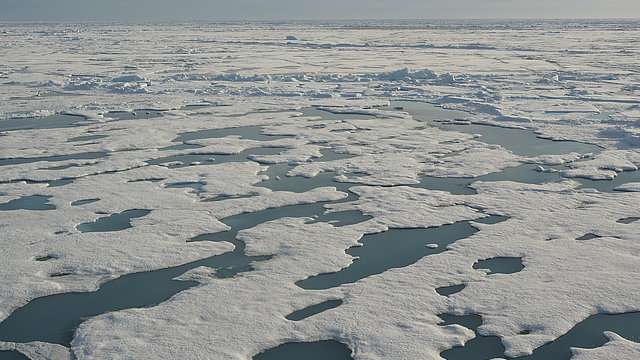
In the Arctic summer, the sea ice melts due to rising temperatures and constant sunlight. When it does, meltwater can gather in pools on the surface, known as melt ponds. These ponds reduce the ability of the surface to reflect incoming sunlight. As they are “darker” than the high-albedo sea ice, they absorb a large proportion of the solar radiation or allow it to pass through the ice into the ocean below (“transmission”). In total, more energy is absorbed, causing temperatures to rise further and more ice to melt. Accordingly, melt ponds are an essential aspect of what is referred to as the ice-albedo feedback effect, which is itself a key component of the processes that lead to far more intensive warming in the Arctic than in the rest of the world. Consequently, it is important to understand where and how these ponds form, and what percentage of the surface they cover.
Melt pond observation
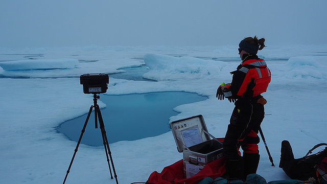
Using satellite data is the only way to observe and assess the surface fraction of melt ponds continually and for extensive areas. But here, too, there are certain limitations on the spatial and temporal coverage. The entire Arctic can’t simply be surveyed at any desired resolution and repetition rate. In order to bridge the gap between detailed measurements like those gathered during the MOSAiC expedition in 2019-2020 and satellite observations that cover the entire Arctic daily, a new study has been released. It is based on reflectivity measurements taken by the European Space Agency (ESA) Sentinel-2 satellites, which offer a spatial resolution of 10m and fly over the same areas of the Arctic (circa 100x100km) every 4 to 5 days. A technique known as spectral unmixing is used to calculate the melt pond and ice fractions, as well as patches of open water, from these measurements. The algorithm was trained and validated with the help of high-resolution satellite and aerial images taken during MOSAiC in the summer of 2020.
In June and July 2020, the data product was used to analyse the development over time of melt ponds on the MOSAiC floe and their representativeness of the immediate vicinity: at the beginning of observation, in June, the MOSAiC floe was characterised by an exceptionally high melt pond fraction, only subsequently becoming more representative of local conditions. This observation is due to the unique ice conditions (thicker and more heavily deformed ice).
Melt ponds in climate models
In addition to detailed local investigations, the data gained can be used to evaluate low-resolution melt pond products. “Because the algorithm is based on a comparison with in-situ measurements, it is ideally suited as a bridge-builder between these local but precise measurements on the one hand and globally available but low-resolution measurements on the other,” says Hannah Niehaus from the University of Bremen, describing the work presented in the study. In this way, Arctic-wide products for the melt pond fraction on sea ice, and their integration into climate models, can be significantly improved.
Original publication and dataset
Niehaus, H., Spreen, G., Birnbaum, G., Istomina, L., Jäkel, E., Linhardt, F., Neckel, N., Fuchs, N., Nicolaus, M., Sperzel, T., Tao, R., Webster, M., Wright, N. (2023). Sea Ice Melt Pond Fraction Derived From Sentinel-2 Data: Along the MOSAiC Drift and Arctic-Wide. Geophysical Research Letters, 50(5), e2022GL102102, https://doi.org/10.1029/2022GL102102
Niehaus, Hannah; Spreen, Gunnar (2022): Melt pond fraction on Arctic sea-ice from Sentinel-2 satellite optical imagery (2017-2021). PANGAEA, https://doi.org/10.1594/PANGAEA.950885
Contact
- Hannah Niehaus (IUP)
- Gunnar Spreen (IUP)
Questions?
Contact us via E-Mail or our contact form.
Graphics
