Glossary
The English version of our glossary is currently under construction and will be regularly updated.
Sea-ice cover
The sea-ice cover has been determined on the basis of satellite data for over 30 years. As a rule, presented as the “sea-ice extent”, as the “sea-ice area” in square kilometres, or as the “sea-ice concentration”.
The sea-ice cover has been determined on the basis of satellite data for over 30 years. As a rule, presented as the “sea-ice extent”, as the “sea-ice area” in square kilometres, or as the “sea-ice concentration”. The ice concentration is normally presented as a percentage (0 to 1 / 0 to 100%) or sometimes in tenths (0/10 to 10/10). A value of 0 means there is no sea ice, while a value of 100 (or 1 or 10) represents seamless ice cover.
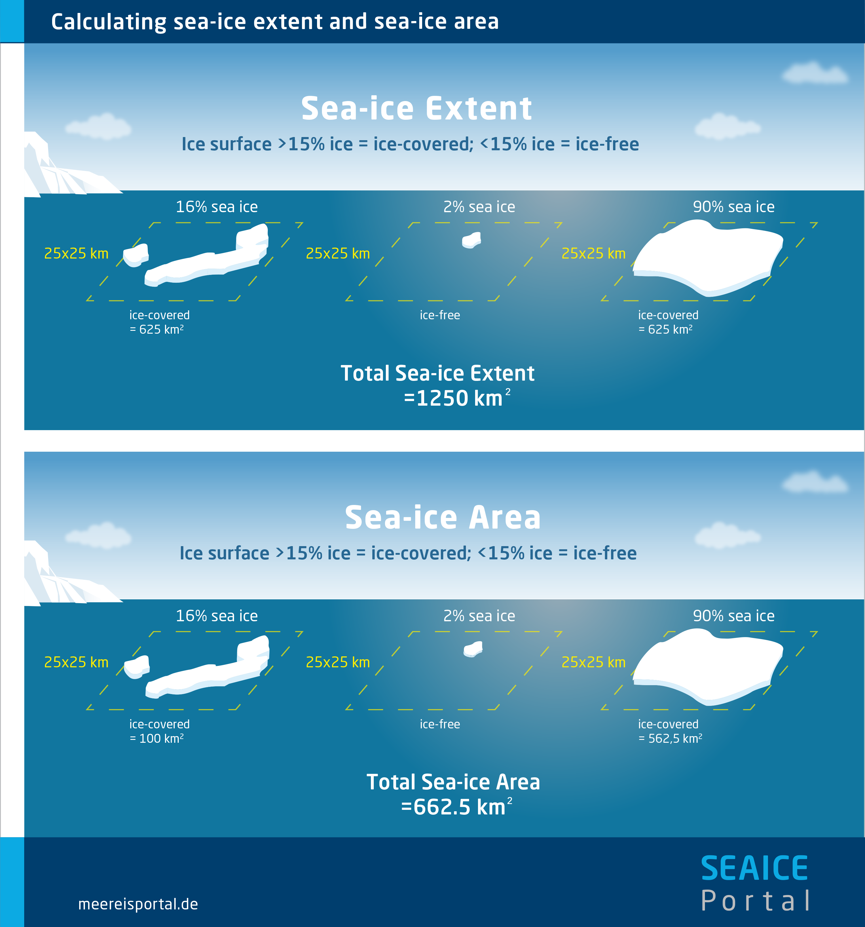
The sea-ice extent and sea-ice area are two different parameters and provide different information.
In this regard, the sea-ice extent is always larger than the sea-ice area. Depending on the intended use, each parameter has its own strengths and weaknesses. To help illustrate the difference between the two, imagine a slice of Swiss cheese. The sea-ice extent would then be the size of the entire slice, including the holes; the sea-ice area would only include the cheese itself, not the holes.
The sea-ice extent defines a given region as “ice-covered” or “ice-free”. For each data cell from the satellite readings, a threshold value is used to determine which category the cell belongs to; a commonly used value is 15 percent. In other words, if the cell’s sea-ice concentration is more than 15 percent, it is classified as “ice-covered”; if it is less than 15 percent, it is “ice-free”. The sea-ice edge refers to the border at which the sea-ice concentration drops below 15 percent.

