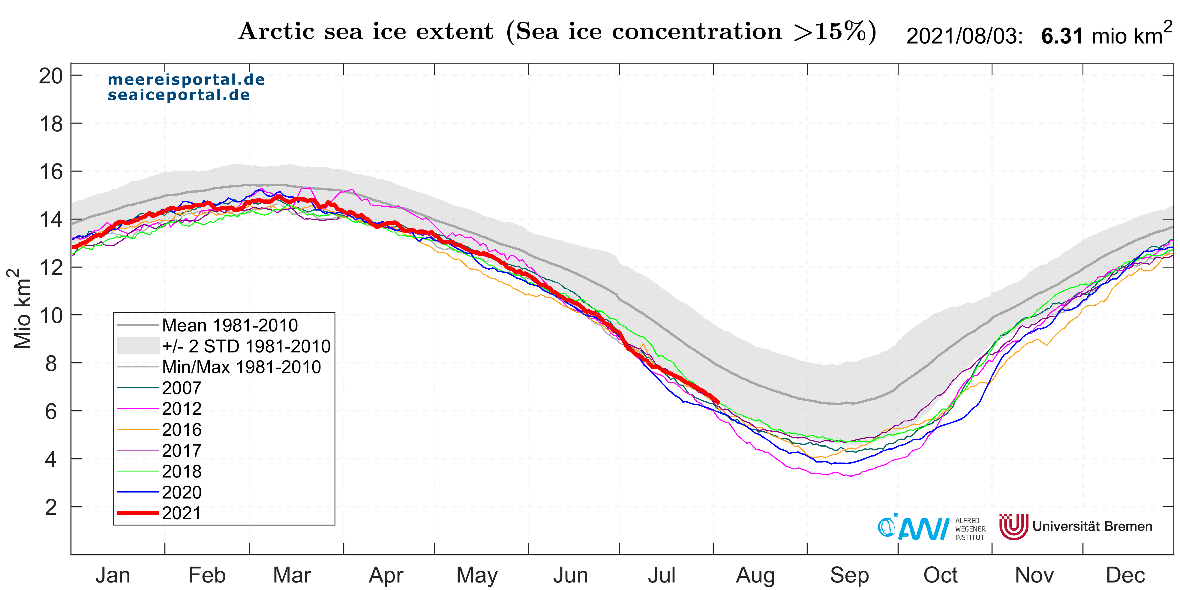
Within a matter of days, the extent decreased by ca. 490,000 km² (an area roughly the size of Spain) and briefly dipped below the record low from 2012 and near last year’s level. However, from 8 July the melting rates became more average and the sea-ice extent hovered near the lower boundary of two standard deviations from the long-term average for the years 1981 to 2010 (Fig. 1).
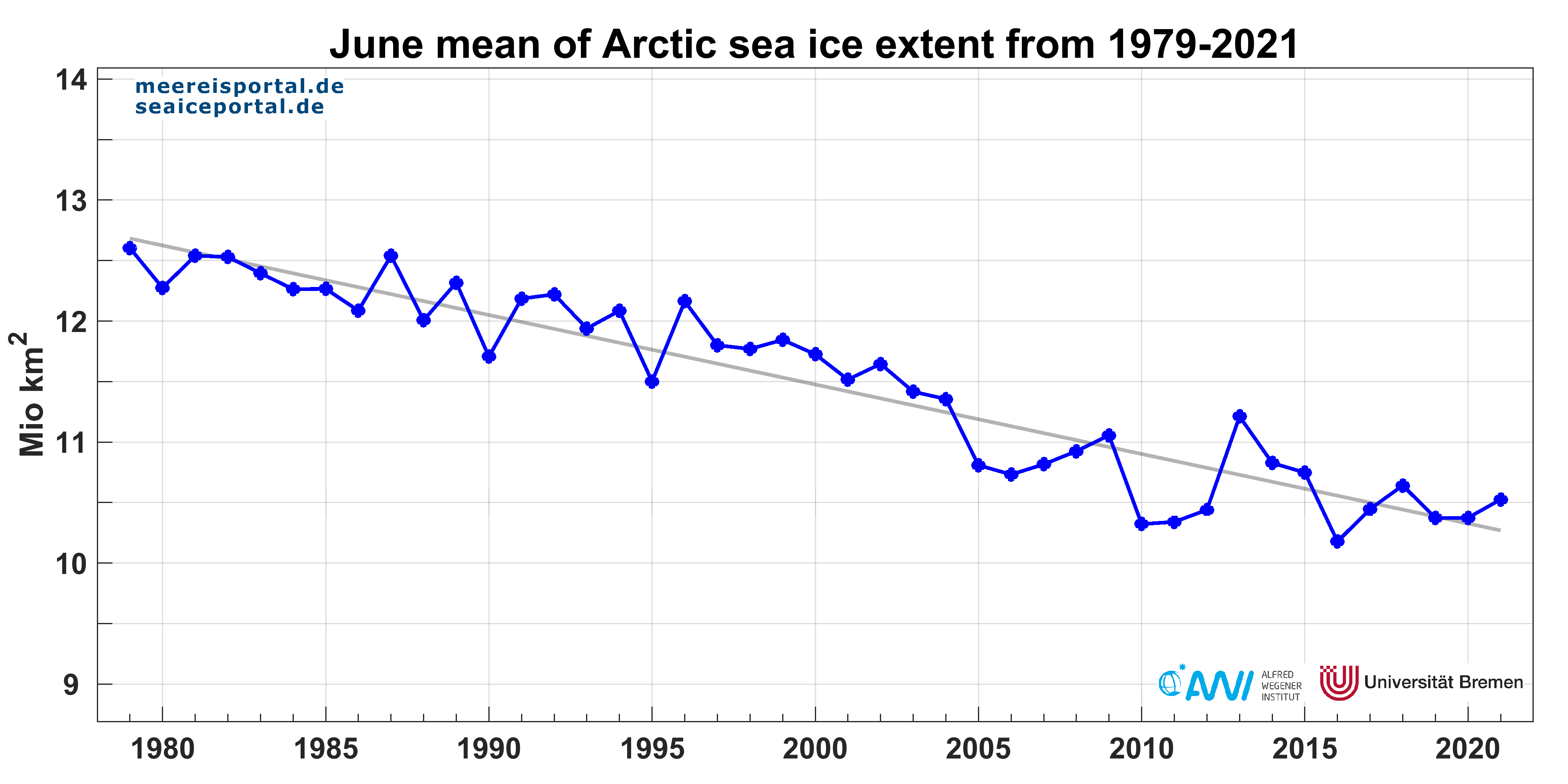
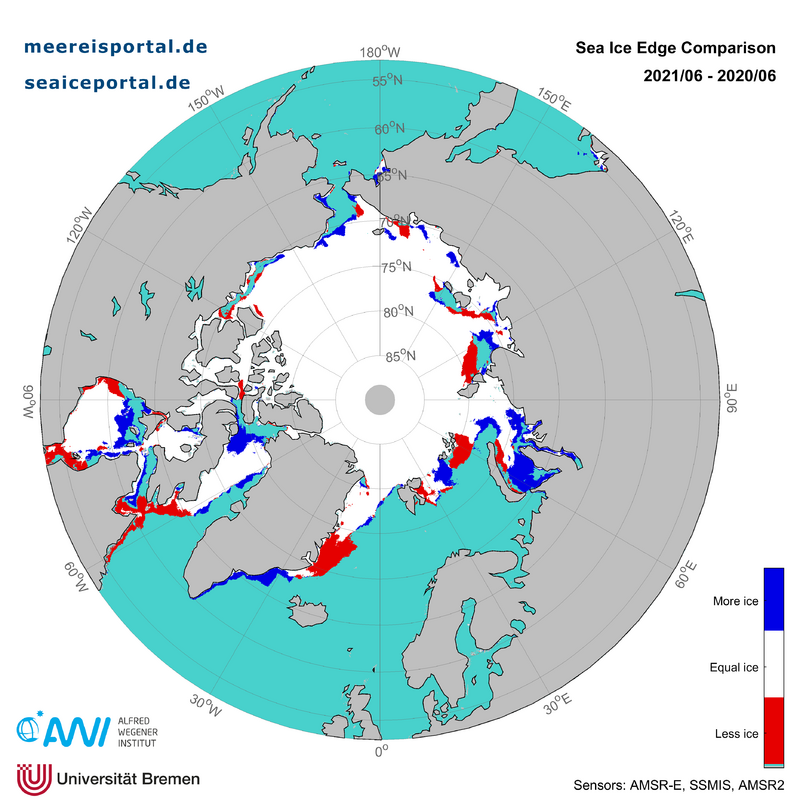
In June, the mean sea-ice extent in the Arctic was 10.53 million km², making it the eighth-lowest value since the beginning of continuous satellite observation in 1979 (Fig. 2). With a mean melting rate of ca. 79,900 km² per day, the ice retreat was moderate. The mean sea-ice extent in June was 1.22 million km² below the long-term average for the month, representing a loss of 4.9 % per decade. Compared to the previous year, there was less ice in the Laptev Sea and northern Barents Sea, though the sea cover was largely intact (Fig. 3). There was only substantially less ice than in the previous year in the southern Denmark Strait, in Hudson Bay, and where Hudson Strait empties into the Labrador Sea.
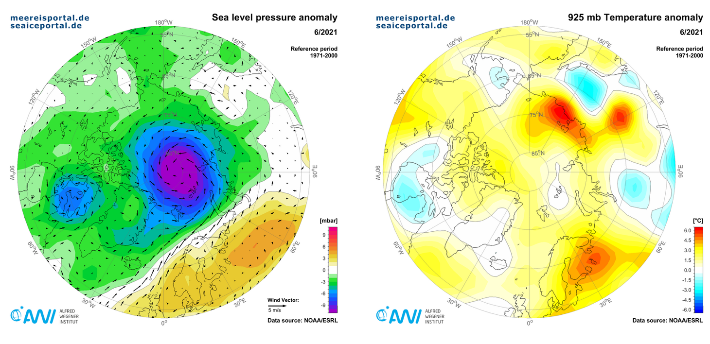
The low-pressure area that had been dominant over the Central Arctic in May spread across the entire Arctic Ocean in June and reached, at more than 10 hPa below the long-term average, an especially low value (Fig. 4). Together with the wide-scale low-pressure anomaly, there was a major high-pressure cell over Western Europe that extended to 90° East and drove warm winds over the Norwegian Sea and into the Barents and Kara Seas, which also explains the intensive ice retreat in the Barents Sea. In northern Finland, this June was the warmest month since the beginning of recordkeeping 144 years ago. Temperatures of over 30°C were measured in northern Finland outside the polar circle. A second warm-air cell spread over northeast Siberia along the coast of the Laptev Sea and over the East Siberian Sea, producing temperatures up to 6° C above the long-term average. In contrast, the majority of the Arctic Ocean was only 1 to 2° C over the average, while certain regions of western Alaska and eastern Canada reported cooler conditions (source: NSIDC).
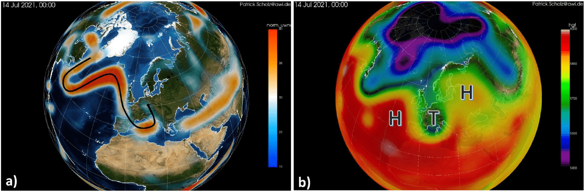
Extremely low air pressure over the Arctic is connected to the positive phase of the Arctic Ocean Circulation and has far-reaching effects on atmospheric circulation patterns, and therefore on climate variability. The Arctic Oscillation (AO) is a large-scale circulation pattern driven by the temperature differences between the cold polar latitudes and more temperate middle latitudes of the Northern Hemisphere. Over the pole, the polar vortex forms, which, as an upper-level low, spins counter-clockwise and is separated from the air masses of the middle latitudes by the strong winds of the polar jet stream. When the contrast in temperatures between the middle latitudes and the polar region lessens, the jet stream falters and begins meandering. As a result, low-pressure or high-pressure areas can more easily stay in one place, which is conducive to prolonged weather situations (Fig. 5). This weather situation was a crucial element in the heat waves and wildfires in North America and the storms and heavy rains in western Germany and neighbouring countries, which resulted in massive flooding and widespread devastation. You can find a detailed analysis of these events here.
Contact
Fragen?
Schreiben Sie uns eine E-Mail oder nutzen Sie das Kontaktformular.
Graphics


