A time-lapse video of the MOSAiC expedition – a one-of-a-kind sequence compiled using a selection from ca. 2.5 million radar images. One of these systems was kept running nonstop throughout the MOSAiC expedition. Despite extreme temperatures, for the first 300 days of the expedition, it consistently provided essential information on the dynamics of the ice pack near the ship. Using selections from the ca. 2.5 million images produced, we have now prepared a video sequence. Two brief sequences on specific events during the MOSAiC drift were already described in the MOSAiC Sea Ice Ticker instalments 25 and 32.
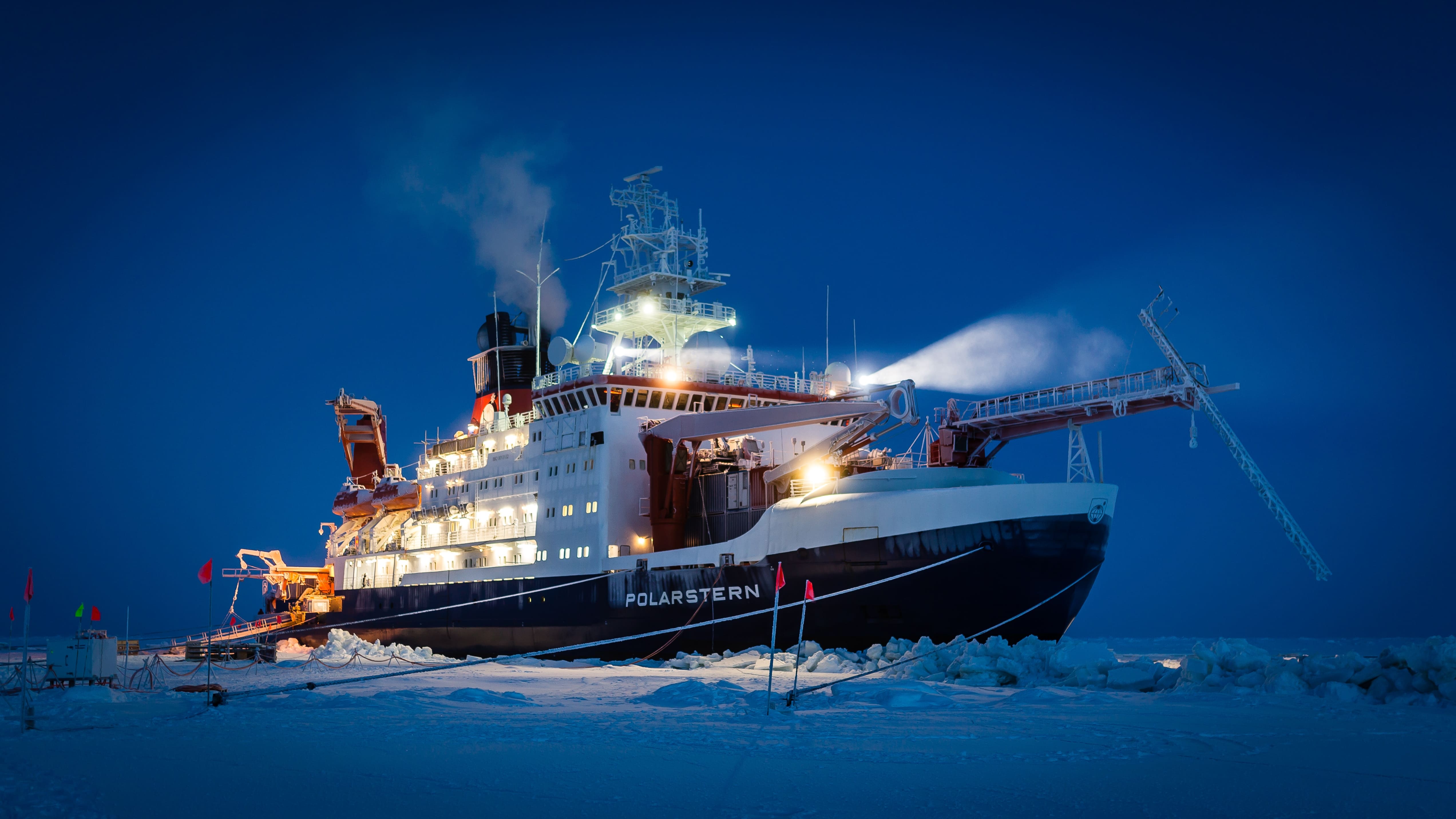
The Research Vessel Polarstern is equipped with various marine radar systems, which are used to identify other ships or obstacles. The systems consist of rotating antennas mounted on the observation deck above the ship’s bridge (see photos). They emit microwave pulses at short intervals, which are reflected by the water or ice pack, before the ship’s radar system registers the returning signal. This produces an image in which the positions of any ice floes in a radius of 3 nautical miles (ca. 5.4 km) and their sizes in relation to the ship can be seen. The systems are unaffected by weather conditions or available light, i.e., they can penetrate rainclouds and fog, and are just as effective at night.
The video sequence begins shortly after RV Polarstern moored at the MOSAiC floe (6 October 2019) and ends when the ship weighed anchor on 31 July 2020. The 300-day-long sequence is only briefly interrupted by the ship’s brief foray to Svalbard, where a crew rotation took place. The Research Vessel Polarstern is always in the centre of the images, which are oriented with north pointing up. The part of the image with no information lies in the radar shadow: that part of the panoramic view that is blocked by on-board structures (here, the smokestack).
At the beginning of the expedition, individual ice floes, some measuring several kilometres in length, could be clearly seen as dark shapes in the radar images. These floes had survived the summer and were roughly 10 months old at the time. The lighter area between the older floes represents young, newly formed ice pack. Since the ice was still relatively thin at the start of the expedition, leads repeatedly formed in the direct vicinity of the ship; this happened less frequently as the expedition progressed. However, strong winds frequently broke up the sea-ice cover, producing either new ice (dark areas) or pressure ridges and shear zones, the result of convergent ice movement. Shortly before reaching Fram Strait (and the end of the expedition), many of the floes began to melt. What remained was a loose collection of floes, which ultimately forced the expedition team to depart on 31 July 2020 and continue the expedition in a region farther to the north.
The images are now intended to facilitate the interpretation of scientific readings taken during the expedition, and to help identify especially important events that influenced the thermal exchange between the ocean and atmosphere.
Download
„Polarstern Ship Radar Video Sequence - A Time-Lapse Video of the MOSAiC Expedition – On-board Radar Images from 300 Days in the Ice”.
Here you can download the video in small, medium or full resolution.
Citation of the video as follows: https://doi.org/10.5446/52953
Contacts
- Dr Thomas Krumpen (AWI)
- Dr Annekathrin Jäkel (AWI) (Animation)
Questions?
Contact us via E-Mail or our contact form.
Graphics


