Passive sensors for visible and infrared light
The light that is visible to our eyes is that part of the solar radiation that is reflected by objects and the surface around us. In this regard, bright surfaces (i.e., those with a high albedo) reflect back more solar radiation than do dark surfaces.
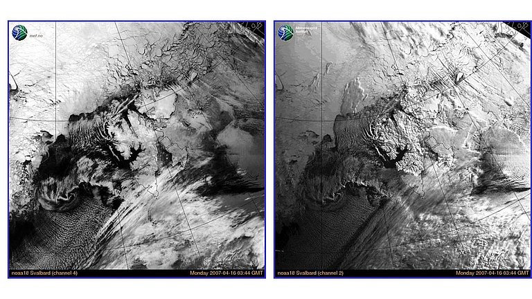
Sea ice has a far higher albedo than the surrounding ocean, allowing it to easily be measured using remote sensors for visible light. However, this type of satellite-based observation of sea ice has a number of limitations. Since the sensor measures the reflected light from solar radiation, data can only be gathered during the day, when the sun is shining, not at night or during the long Polar Night. Moreover, because clouds reflect visible light, overcast skies mean the satellite is unable to “see” and measure the sea ice below the clouds. Especially in summer, the ice-covered polar regions tend to be obscured by substantial cloud cover.
Due to these limitations, satellite sensors that use reflected sunlight can’t offer a comprehensive image of the ice-covered regions. The near infrared (NIR) frequency range, the next range after visible light (700 nm – 3 µm), is also reflected sunlight. As such, it is subject to the same limitations as visible light.
Satellite sensors for infrared radiation with a wavelength of 10 µm – 12 µm (thermal infrared) measure the heat radiation emitted by a given object on the Earth’s surface. Objects with a mean temperature of between –50 degrees Celsius and +50 degrees Celsius emit the majority of their energy in the form of thermal infrared radiation. Sensors for thermal infrared can detect sea ice comparatively easily, since the ice is generally far colder than the surrounding ocean. In winter, the surface temperature of sea ice is typically between –40 degrees and –20 degrees Celsius, whereas the temperature of the ocean is near the freezing point. This all changes in summer: on its surface, the temperature of the melting sea ice is near the freezing point, making it virtually impossible for sensors to differentiate between it and the similarly cold water of the open ocean. Clouds also make it difficult to measure the ice, because they both emit and absorb infrared radiation.
Infrared sensors, which are routinely used to observe ice cover, have a spatial resolution of one to several kilometres and cover a swathe measuring between a few hundred and over 2,000 kilometres wide on each flyby.
Many satellite sensors measure not only in the visible and near-infrared but also the thermal infrared range. The MODIS sensor, which has been in use for nearly two decades, is a good example of the regular, broad-scale observation of the Earth’s surface in exactly these ranges. Further examples are the AVHRR (Advanced Very High Resolution Radiometer) and somewhat newer Sentinel-3 (ESA) sensors. In terms of their design, Sentinel-2 and the series of Landsat systems (1972 to present) are very similar (multi-spectral sensors employing multiple channels in various frequency ranges) but offer significantly higher geometrical resolution and reduced temporal resolution (i.e., they fly over a given point on the Earth’s surface less frequently).
Despite the current gaps in the data (due to cloud cover), especially the ice’s surface temperature, determined on the basis of thermal infrared data, is an important parameter for characterising the sea-ice surface, because it allows conclusions to be drawn on the sea-ice thickness – the thinner the ice, the closer its surface temperature is to the freezing temperature of the ocean. This can be used in a range of scientific applications, e.g. calculating the thickness of thin ice layers, detecting leads, and assessing sea-ice concentrations in high spatial resolution.

