Glossary
The English version of our glossary is currently under construction and will be regularly updated.
- A(31)
- B(17)
- C(44)
- D(20)
- E(30)
- F(18)
- G(15)
- H(10)
- I(27)
- J
- K(4)
- L(9)
- M(16)
- N(6)
- O(13)
- P(36)
- Q
- R(14)
- S(45)
- T(23)
- U(5)
- V
- W(3)
- X
- Y(1)
- Z(1)
- 0(2)
Lactation period
Breastfeeding time, the time after childbirth when milk is produced and shared.
moreLagrangian approach
Measurements are taken along the path (of the trajectory). The measuring point moves with the subject.
moreLand use
How human beings put land to use.
moreLand-use change
Refers to changes in how land is used or managed by human beings.
moreLaser altimetry
“Altimeter missions” are used to measure the elevation of the Earth’s surface, and therefore also the elevation of the sea-ice surface.
moreLead
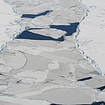
Generally speaking, every navigable break or channel in the sea ice that is too wide to jump across. A lead can contain open water (open lead) or be covered with ice (ice-covered lead).
more
Level ice
Sea ice that has not been affected by deformation / has not been deformed.
moreLIDAR
Optical measuring method used to assess the atmosphere with the aid of laser-based range finding.
moreLithosphere
The Earth’s crust and the topmost part of its mantle. The lithosphere forms our planet’s outermost shell and consists of individual plates that are in motion.
more